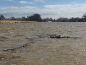
Slowly but surely, water levels are coming down following the worst flooding in Chatham-Kent in over 40 years.
According to a bulletin issued Sunday evening by the Lower Thames Valley Conservation Authority, water levels on the Thames River are dropping throughout the watershed, from Middlesex and Elgin down to the mouth of the river at Lighthouse Cove. However, abnormally high water levels are expected to stick around through at least the middle of the coming week.
The LTVCA says water levels in Middlesex and Elgin are down by 4m and draining out of the river flats. At Thamesville, where severe flooding occurred on Friday, water levels are down by 1.8m as of 8:30pm Sunday.
In the city of Chatham, where water was rising at a dramatic rate Friday afternoon, water is down about 25cm from the peak of 180.2m Saturday night.
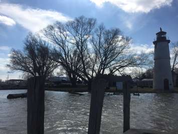
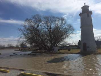
Water levels are still high at Lighthouse Cove, near Lakeshore. Water was high enough Sunday afternoon to reach the lighthouse on the Lake St. Clair shore.
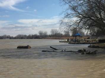
The LTVCA says many of the smaller watercourses downstream in the watershed are seeing high water due to the Thames River backing up into them.
The receding water levels are expected to be helped along by the weather forecast. Temperatures are expected to remain above freezing for most of the week, with clear skies in the forecast through Thursday.
The conservation authority says people should stay away from the river, streams and ditches. The combination of slippery and muddy banks, floating debris and fast-moving cold water can be deadly. Standing water can also be harmful on its own with unseen hazards.
A state of emergency remains in effect in Chatham-Kent.