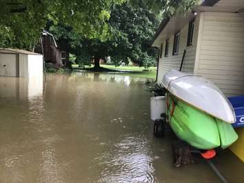
Flooding is still an issue in the St. Clair Region as another five to 10 millimetres of rain fell Friday night into Saturday.
Water levels are receding as of Sunday morning but some locations are experiencing high water levels into floodplain areas.
"The process for opening the gates of the McKeough Dam has begun as of 7 a.m.," the St. Clair Conservation Authority said in a statement.
A flood warning continued in the area late Sunday afternoon.
The following roads are closed because of flooding:
Stanley Line between Kimball Road and Waubuno Road
Plowing Match Road between Rokeby Line and Petrolia Line
Black Ash Road between Durham Creek Line and Rokeby Line
Gypsie Flats Road between Durham Creek Line and Rokeby Line
"Individuals are reminded to avoid watercourses and flooded areas due to dangerous conditions, slippery banks and cold, swift moving water," the conservation authority said.
The flood warning is expected to stay in effect until Tuesday.