Flooding. Photo courtesy of the St. Clair Region Conservation Authority.Flooding. Photo courtesy of the St. Clair Region Conservation Authority.
Sarnia

Potential for flooding following rain event

The St. Clair Region Conservation Authority has issued a flood watch, following significant rainfall over the past two days.

The recent low pressure system dumped between 15 and 45 millimetres of rain across the region.

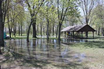
The authority said elevated water levels are continuing to rise slowly into floodplain areas in Brigden, Florence, Alvinston and Petrolia.

Flooding has forced the closure of Waterworks Road from Moore Line to Courtright Line and Fairweather Road between Oil Springs Line and Aberfeldy Line.

The authority said there's also the potential for flooding along Stanley Line between Kimball Road and Waubuno Road, as well as on Pretty Road north of McCallum Line.

Residents are reminded to avoid watercourses and flooded areas due to slippery banks and swift-moving water.

Read More Local Stories

New military crosswalk rendering. (Image courtesy of the Sarnia Legion Branch 62)

New military crosswalk in Sarnia to be unveiled

As part of a partnership between the Sarnia Legion Branch 62 and City of Sarnia, an unveiling ceremony will be held at the corner of Christina Street and Wellington Street on Sunday, June 7, at 2 p.m.

Members of the Sarnia Police Service entering a Tashmoo Avenue residence on June 4, 2026. (Photo courtesy of the Sarnia Police Service)

Two men arrested in Tashmoo Ave. standoff

Sarnia police said the investigation began on May 29 after the victim was allegedly attacked by acquaintances at a residence near Tashmoo Avenue and Christopher Drive at Aamjiwnaang First Nation.