The president of the Bruce County Federation of Agriculture says it's a major, positive step forward.
However, Les Nichols warns it's no guarantee the Gay Lea expansion project in Teeswater will go ahead.
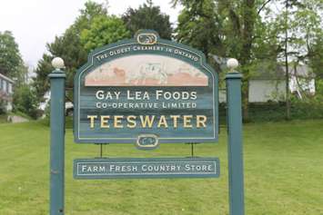
The Municipality of South Bruce and Saugeen Conservation are looking at updated flood plain mapping in Teeswater, including the Gay Lea Cooperative's facility.
Concerns about the expansion project's possible flood plain impact have created delays in its approval.
Nichols points out the mapping the authority is currently using includes the Teeswater dam, which was removed in the early 1990's.
Because it was just upstream from the Gay Lea facility, he suggests its no longer being there would already have an impact on that flood plain mapping.
"That used to have probably a 4 or 5 acre mill pond behind it that had, it was probably close to 10 feet deep in the middle that's not there anymore. Obviously, the cavity is still there, but there's no water in it other than the river running through it."
He's also concerned the cost - which he estimates could be between 40 and 70 thousand dollars - is going to be charged to the municipality.
"For a small, rural municipality that's really struggling with the tax base it's a lot of money to invest that you're not really sure is going to get you anything back I guess is where my concern comes in and I think I share that with others. Others seem maybe more confident if the do this it's a given they'll go ahead, but I certainly can't see as I've seen anything that would confirm that."
He says the Gay Lea situation is part of the same picture the Bruce Federation complained about earlier when it took concerns to municipalities and the Saugeen Conservation board.
While they haven't seen any huge changes in the way Saugeen Conservation operates yet, Nichols says the board does seem to be more aware of issues and that may have had an impact on how it's now handling the Gay Lea situation in Teeswater.
===
Nichols says one of his concerns is the 40-70 thousand dollar cost of the mapping.
[audio mp3="http://blackburnnews.com/wp-content/uploads/2016/05/NICHOLS-Maps-1.mp3"][/audio]
===
Nichols points out the mapping the Conservation Authority is using now dates back to before the Teeswater dam was removed.
[audio mp3="http://blackburnnews.com/wp-content/uploads/2016/05/NICHOLS-Map-2.mp3"][/audio]
===
While the federation agrees with the water quality mandates of Conservation Authorities, Nichols points out those authorities also need municipalities to have a strong tax base to preserve their own funding.
[audio mp3="http://blackburnnews.com/wp-content/uploads/2016/05/NICHOLS-Map-3.mp3"][/audio]