Lake effect snow could still hit parts of the region today despite the snow squall watch ending.
"There could be a fair amount of variability depending on where you are in the region, but it is possible that locally we could see amounts of somewhere between 5 to 10 cm if one of these bands locks in for any period of time," said Geoff Coulson, Warning Preparedness Meteorologist with Environment Canada.
It's unusual for snow from Lake Huron to reach Chatham-Kent, but Coulson said the wind is blowing from the north.
"Many of our stronger lake effect events tend to happen with winds from the northwest or winds from the west. That tends to make the activity more concerned for places like Middlesex County or Huron and Perth County," said Coulson. "So for the next number of hours though, with these winds from the north, there is still that possibility of some stronger flurry activity extending as far south as into the Chatham-Kent area."
The northern parts of Chatham-Kent could get hit the hardest, but the worst of the squalls should be on Monday afternoon.
"Those are the areas at are more likely to see a notable accumulations. But I'm looking at radar right now, some of the bands of snow, some of the flurry activity, is extending as far south as areas close to Lake Erie," said Coulson. "As we get to late afternoon and evening hours, we're expecting the winds to shift and blow from the Northwest. That'll shift the flurry activity out of Chatham-Kent and more into the Middlesex County area."
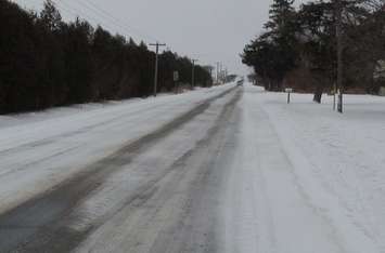
Motorists are reminded to slow down and drive to the conditions.
"Anyone planning travel today across Southwestern Ontario, especially up through Eastern Lambton County, Middlesex County, or Huron County, should be advised that there is actually a snow squall warning in effect for those areas," said Coulson. "They're expected to get even more intense bands of snow both today and overnight."
Coulson added that the temperature will return to more normal levels later this week.
"Today and Tuesday, Remembrance Day are expected to be notably colder than normal. Expected to make it up to 3 degrees for the high on Tuesday, but still well below our normal high of 9 degrees for this time of year. We do see a return to more seasonal temperatures by Wednesday, back up to a high of 8 degrees, and that's around where the high is going to remain as we finish off the work week and head into the weekend."