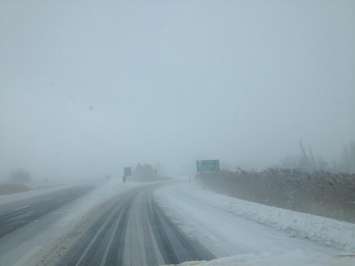
As Midwestern Ontarians brace for an early spring storm, Environment Canada has issued a weather forecast warning of significant rainfall, snowfall, and strong winds.
A special weather statement has been issued for Grey, Bruce, Huron, Perth, and Wellington counties. A Colorado low is expected to impact the region, bringing strong easterly winds with gusts up to 70 km/h, possibly exceeding 80 km/h along the shores of Lake Huron and Georgian Bay. The storm will also lead to accumulating snowfall, especially in areas along the Niagara Escarpment northwest of the Greater Toronto Area.
Tuesday, periods of rain are expected, with rainfall amounts ranging from 5 to 10 mm. Wind speeds are forecasted to be east at 40 km/h, gusting up to 60 km/h.
Tuesday night, the rain will continue, changing to periods of drizzle or a few showers near midnight. There is also a risk of a thunderstorm in the evening. Rainfall amounts will remain between 5 to 10 mm, accompanied by southeast winds at 50 km/h, gusting to 70 km/h.
Moving into Wednesday, the weather will stay cloudy with a 40 per cent chance of showers. Rain is expected to begin late in the afternoon, with southeast winds at 30 km/h becoming light late in the morning. Wednesday night will see rain showers or flurries, along with windy conditions. The outlook for Thursday includes periods of snow or rain.
The storm's track remains uncertain, which could significantly impact temperatures, snowfall amounts, and the transition from rain to snow.
**with files from Mark Brown