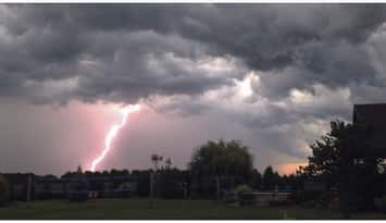
Environment Canada has forecasted severe thunderstorms once again Friday.
The national weather agency posted a severe thunderstorm watch for Sarnia-Lambton, Windsor-Essex, Chatham-Kent, and western Middlesex and Elgin counties just after 4 p.m.
A severe thunderstorm warning was issued for Sarnia-Lambton at 4:25 p.m. Chatham-Kent and western Middlesex and Elgin counties were added to the warning a short time later.
Just before 7 p.m., all warnings were downgraded back to thunderstorm watches.
They said an area of severe thunderstorms was expected to develop over Michigan in late afternoon and move into southwestern Ontario.
The main threats are said to be wind gusts up to 90 km/h, heavy rainfall with local amounts of 50 mm, and up to toonie size hail.
We're reminded that large hail can damage property and cause injury.
Strong wind gusts can toss loose objects, damage weak buildings, break branches off trees and overturn large vehicles. Heavy downpours can cause flash floods and water pooling on roads.
Water-related activities may be unsafe due to violent and sudden gusts of wind over bodies of water.