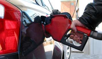
The mercury climbed to new heights in Sarnia Monday morning.
We set a new record high, surpassing the previous record of 15.6 C set on March 4, 1966. It got up to around 21.4 C by late afternoon.
Environment Canada Meteorologist Geoff Coulson said the warmer than normal trend seen in February is continuing.
"The normal high for this time of year is 4 C," said Coulson. "We're not going to see anywhere near four degrees potentially until Sunday when it looks like we finally settle back, at least for a day or two, into more seasonal temperatures. But, between now and then the overall trend is to remain well above the seasonal normal."
Coulson said February was the warmest February on record at the Chris Hadfield Airport.
"It's really hard to call anything about his past winter normal," said Coulson. "With the fact that we've been steadily milder than normal since winter officially began back in December."
We set a new record high at least three times last month in Sarnia.
The most recent was last Tuesday when the temperature climbed above 20 degrees.
Coulson said one of the big drivers for the milder than normal winter was El Nino.
"That's the warmer than normal water in the Pacific Ocean off the coast of South America," said Coulson. "When these El Ninos occur, they tend to give us these milder than normal winters and that's certainly been the case. Another underlying factor could also be climate change. Overall the winters becoming so much shorter, the snow season becoming so much shorter as the decades go by."